ブックタイトル東北大学復興アクション 5版
- ページ
- 8/66
このページは 東北大学復興アクション 5版 の電子ブックに掲載されている8ページの概要です。
秒後に電子ブックの対象ページへ移動します。
「ブックを開く」ボタンをクリックすると今すぐブックを開きます。
このページは 東北大学復興アクション 5版 の電子ブックに掲載されている8ページの概要です。
秒後に電子ブックの対象ページへ移動します。
「ブックを開く」ボタンをクリックすると今すぐブックを開きます。


東北大学復興アクション 5版
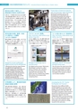
PROJECT 1災害科学国際研究推進プロジェクトInternational Research Institute Project on Disaster ScienceTohoku University Reconstruction Action東北大学復興アクション東日本大震災で被災した歴史資料の救済と知見の共有日本には、その固有の歩みを伝える古文書その他の歴史資料が膨大に残されています。東北大学は2003年から、宮城県や岩手県で、地域の行政や市民と、それらを災害から守る活動を進めてきました。その活動が、東日本大震災で被災した地域の歴史資料約6万点の救済に大きな役割を果たしました。平時の連携が、歴史文化を災害から守ることが実証されました。Preservation of historical materialsafter the Great East Japan EarthquakeHistorical documents, such as olddocuments, are to be found in anoverwhelming quantity and variety inlocal society throughout Japan. Webegan 'historical preservation activities'throughout Miyagi and Iwate Prefecturesince 2003, in cooperation with Localgovernment and citizens. This activitiesand existing network enabled us topreserve about 60,000 damaged recordsin disaster areas. It is important to startpreservation activities prior to actualdisasters.東北沖地震の観測と地質調査から読み解く超巨大地震の発生2011年東北地方太平洋沖地震の際に、超巨大地震にともなう海底の動きを世界で初めて観測。この貴重な観測結果を国内外の研究機関と共有し、他地域での巨大地震発生の可能性を事前に評価する手法を探っています。また、津波堆積物や海岸線の数十万年間の隆起沈降史を調査し、東北沖地震と比較することによって、超巨大地震発生の解明に取り組んでいます。Mega-quakes revealed fromgeophysical and geological surveysWe obtained the world’s first record ofocean bottom movement associatedwith a mega-quake in 2011. Sharing thedata and scientific lessons from theTohoku earthquake internationally withother institutes, we develop an approachto evaluate mega-quake potential,together with pre-historical andgeological evidence for giant quakes.津波の遡上を再現する3Dシミュレーターの開発富士通(株)と共同で、三次元津波シミュレーターを開発しました。。津波が市街地や河川を遡上する様子を精密に再現し、津波被害を高精度に予測することが可能になりました。震災記録の収集・整理・発信から国内外への展開(みちのく震録伝)震災の記録を35万点以上収集し、約10万点を公開しています。また、震災アーカイブの基礎となる手法・技術を確立し、他のアーカイブ団体等に技術展開を行っています。「カワルみちのく風景」http://michinoku.irides.tohoku.ac.jp/photovr/map.html「みちのく震録伝」では、同じ場所で異なる時期に撮影された被災地の写真を収集しています。このサイトでは、それらの写真を比較しながら閲覧できるよう公開しています。「ヒトの目に映る3.11津波浸水」http://michinoku.irides.tohoku.ac.jp/ttjt/ttjt_view.htmlインターネット上で東日本大震災の津波の痕跡高を公開しています。鳥瞰的に津波の痕跡高を見ることで、東日本大震災の津波の高さや驚異を実感することができます。誘発地震の長期的発生履歴の解明Reccurence history of inland seismicityinduced by megathrust Eq.東北日本弧NE Japan Arc超巨大地震の震源Megathrust Earthquake大地震発生サイクルに起因する海岸の隆起沈降履歴の解明Vertical motion of costal regionin geolotical time scale海底地殻変動観測の実施と観測技術の高度化Seafloor geodetic monitoringand technological development東北沖地震の地震前・地震時・地震後の地殻変動の包括的理解Pre-, co-,and post-seismic processesaccociated with the 2011Eq.東北地方太平洋沖地震の巨大津波波源域Source area ofthe 2011 Tohoku Eq.千島弧Kuril ArcDevelopment of a 3D simulatorto replicate tsunami run-upWe developed a 3D tsunami simulatorin collaboration with Fujitsu. It enableus to reproduce tsunami run-up intocities and up rivers in great detail, andto estimate tsunami damage in thefuture with great accuracy.太平洋プレートPacific PlateResearch on post-earthquakedigital archives and its developmentFollowing the Great East Japan Disaster,we collected and organized over350,000 records of the earthquake, outof which 100,000 items were madeavailable for public information anddisaster prevention and risk reduction.Through these activities, we havedeveloped the technologies and themethods necessary for thedevelopment of earthquake archives.Changes in landscape due toreconstructionOur digital archive project "MichinokuShinrokuden"continues to collectphotos of disaster sites, changingaccording to recovery processes,captured in the same places. Theproject also has a website that enablesthese photos to be viewed whilecomparing them.Seeing the March 11th tsunamithrough human eyesThis site shows the water level of thetsunami that occurred in the GreatEast Japan Earthquake on GoogleEarth, to enable a birds-eye view ofthe height of the tsunami, so that itcan be easily visualized.新しい「広域被害把握技術」巨大地震発生直後から即座に数値シミュレーションが実施できるよう研究を進めています。津波被災地を探索して人的被害・建物被害を推計するための被害予測、広域に発生した被害の空間分布を把握するリモートセンシング技術、被災後の復旧・復興過程をモニタリングするセンシング技術、空間情報処理技術についての技術基盤を融合し、新しい減災技術を創成しました。Enhancing disaster resilience by fusionof simulation, sensing and geoinformaticsWith use of modern computing power, wedevelop a new framework to search anddetect the impact of natural disaster byintegrating real-time computing, damage/lossestimation models, remote sensing andgeo-informatics. The most important missionof our laboratory is to enhance the capabilitiesof disaster response/relief efforts andhumanitarian activities by providing ourresearch outcomes with particular regard tosearching and mapping the areas and impactsof natural disasters.文理連携により、慶長奥州地震・津波の実像を解明専門分野の異なる研究者が、文系、理系の垣根を取り払って、江戸時代の地震と津波の実像の解明に取り組みました。古文書や津波堆積物から津波伝播のシミュレーションを計算するなど、共同作業により、400年前の慶長欧州地震が東日本大震災と同規模で、同じような津波が襲来していたことがわかりました。Investigating the 1611 KeichoEarthquake and TsunamiResearchers from different fieldsworked together to try to get a realimage of the earthquake and tsunamithat happened in the early 1600s. Wecalculated a simulation of the tsunami’sspread from old historical documentsand tsunami deposits. From thiscollaborative effort, we discovered thatthe 1611 Keicho Earthquake was on thesame scale as the Great East JapanEarthquake and resulted in a similartsunami in the same area.災害科学情報の多次元統合可視化システム災害科学国際研究所の各研究部門・分野の種々の自然災害に対する研究成果を、災害科学情報として集積・統合化し、重層的に3次元可視化することにより災害科学の進化、実践的防災学の体系化および災害に強く、レジリエントな社会システムの構築のための見える化プラットフォームとして活用します。Integrated multi-dimensionalvisualization system fordisaster science informationA variety of research outcomesproduced from all the divisions inIRIDeS are integrated and visualized atmultiple levels. The system serves as avisualization platform that enables usto establish a new and practicalframework for realizable disasterprevention and mitigation systems toencourage resilient societies.07 08